Reaching the Bushiribana Gold Mill Ruins is a journey of transition. You leave behind the manicured lawns and paved boulevards of Aruba’s resort districts, heading toward the rugged, wind-sculpted north coast. Understanding the topography is essential; while the island is small, the terrain surrounding the ruins is unforgiving, shifting from smooth asphalt to volcanic rock and coral dust in a matter of minutes. Whether you are navigating by 4×4 or a standard rental, the approach requires a strategic choice between the efficient inland path and the scenic coastal trail.
Navigational Overview: Reaching the North Coast
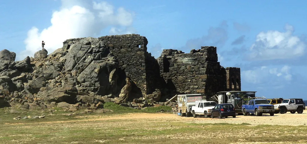
The Bushiribana Gold Mill Ruins sit as a central hub on the northern shoreline, positioned strategically between the California Lighthouse to the west and the entrance of Arikok National Park to the east. The trade winds here are relentless. They have spent millennia carving the limestone cliffs into sharp, jagged edges that demand respect from any driver. To reach the site, you must cross the “pavement threshold”—the point where the island’s modern infrastructure gives way to the primordial coastal geology of the windward coast.
There are two primary philosophies for the drive: the “Smooth Approach” via Santa Cruz and the “Scenic Trek” along the coast. While the island is only 20 miles long, the difference in road quality between these two paths can add significant time to your itinerary. For those interested in the architectural mastery of the ruins, arriving with a vehicle (and tires) intact is the first priority.
| Starting Point | Estimated Drive Time | Recommended Vehicle | Primary Route |
|---|---|---|---|
| Queen Beatrix Airport (AUA) | 25–30 Minutes | Standard / SUV | Route 4 (Inland) |
| Oranjestad Cruise Port | 20–25 Minutes | 4×4 Recommended | Coastal Route 6 |
| Palm Beach Resort Area | 30 Minutes | 4×4 / Jeep | Northern Coastal Track |
| Natural Bridge Ruins | 2 Minutes | Any (High Clearance) | Direct Shoreline Path |
Digital Navigation: Avoiding Common GPS Pitfalls
Avoid the “Bushiribana” Ambiguity: Simply searching for “Bushiribana” on Google Maps or Waze can be a tactical error. The name refers not just to the coastal mill, but also to the network of 19th-century mine shafts located further inland in the hills. Following a generic search often leads drivers toward abandoned hilltop trails that are completely inaccessible to vehicles, leaving you stranded far from the sea-facing smelter structure described in the Aruban Gold Rush Chronicles.
The Golden Coordinates: For a direct route to the sea-facing ruins and the informal parking flats, input 12.5583° N, 69.9744° W. Because cellular service is notoriously intermittent along the limestone cliffs, we strongly advise downloading offline maps before leaving your hotel. Relying on a live data stream in the middle of a desert track is a risk that often results in missed turns at poorly marked coral junctions.
The Santa Cruz Inland Access (Route 4)
For those driving standard sedans or compact rentals, the Santa Cruz route is the most reliable choice. Departing from the central town of Santa Cruz, you will follow the signs toward the coast. This path minimizes exposure to the deep ruts and sharp coral rocks found on the shoreline tracks. While the pavement eventually ends near the coast, the final stretch of dirt road from this direction is generally hard-packed and manageable, provided you drive slowly to avoid undercarriage damage. This route is favored by travelers who want to visit the site before heading to a nearby local food truck for a snack.
Route 4 acts as the primary artery for the island’s interior. As you move north from Santa Cruz, the landscape shifts from residential clusters to cacti-filled plains. This is the most efficient way to reach the ruins if you are coming from the southern half of the island or the airport, as it bypasses the slower, winding coastal tracks that can be taxing on both the driver and the vehicle’s suspension.
The Route 6 Coastal Connection
Known locally as the “Coastal Highway,” Route 6 is less of a road and more of a series of interconnected coral tracks that run parallel to the Caribbean Sea. This is the preferred route for adventure seekers and those already exploring nearby attractions. From this track, the Bushiribana Gold Mill Ruins act as a central landmark. You are only a 2-minute drive from the Natural Bridge ruins and a 15-minute trek from the peaceful Alto Vista Chapel. Look for the massive stone silhouette on the horizon; the ruins are so large they serve as their own visual marker once you pass the Natural Bridge area.
Transit from Queen Beatrix International Airport (AUA)
If you are heading straight to the ruins upon arrival at AUA, the logistics are straightforward but require a shift in mindset. Exit the airport and follow the signs for Santa Cruz/Arikok National Park. The drive takes approximately 25 to 30 minutes. Initially, you will be on modern, well-maintained roads, but as you veer north toward the coast, the infrastructure tapers off. It is vital to consult our Essential Visitor Planning page regarding the lack of amenities at the site; ensure you have water before leaving the airport vicinity.
Navigation Warning: Most standard car rental contracts in Aruba explicitly void insurance coverage if the vehicle is driven on the unpaved North Coast roads. Always check for “Off-Road” clauses before attempting the drive in a 2WD sedan, or you may be liable for any undercarriage damage caused by volcanic rock.
Airport Taxi Logistics and Fair Pricing
Taking a taxi to the ruins is possible but requires careful negotiation. Taxis in Aruba operate on a fixed-rate system based on zones, rather than meters. A one-way fare from the airport or the high-rise hotel district typically costs between $40 and $55 USD. However, there is a significant catch: there are no taxis stationed at the ruins for a return trip. You must either book a “round-trip” with your driver or pay an hourly rate, which usually starts at $60 USD per hour. Without a pre-arranged pickup, you may find yourself stranded in a remote area with no shade and no reliable transport.
Cruise Port Transit and Public Bus Limitations
For passengers arriving at the Oranjestad cruise port, the ruins are roughly 20 to 25 minutes away by car. Many passengers opt for the “Off-Road Heritage” UTV or Jeep tours that depart directly from the terminal. These tours cost between $180 and $280 per vehicle and provide the most seamless way to see the ruins without worrying about navigation or vehicle damage. If you prefer a private taxi, follow the same “round-trip” advice mentioned above.
The Arubus Limitation: It is a common misconception that the public Arubus system services the ruins. It does not. The closest bus stop is in the town of Santa Cruz (Line 2, 3, or 4). From that stop, it is a 5.5 km (3.4 mile) walk to the ruins. This walk takes place in intense, direct sunlight with 0% shade and temperatures often exceeding 90°F (32°C). For safety reasons, we strongly discourage tourists from attempting to reach the ruins on foot from the bus stop. Sturdy footwear and hydration are essential even for those driving, as detailed in our packing essentials guide.
Vehicle Clearance and Driving Safety
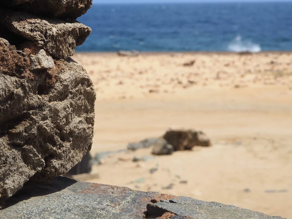
While a 4×4 vehicle is not strictly required if you utilize the Santa Cruz inland route, a minimum ground clearance of 8 inches is highly recommended. The final half-mile to the ruins involves navigating around “Wish Rock Garden”—a field of stacked stones and volcanic outcrops. Standard economy rentals, such as the Kia Picanto, are prone to punctured tires and front-bumper damage on these sharp rocks. If you are driving yourself, consult our guide to Aruban roads to understand the local right-of-way customs and how to handle the “dust-outs” that occur when large tour groups pass by.
Guided Transport & Expeditions
For those who prefer not to navigate the rugged terrain themselves, organized expeditions are the most popular method of reaching the ruins. These tours typically depart from the major resort areas at 8:00 AM or 1:00 PM to avoid the most intense midday heat. By joining a tour, you gain the benefit of a professional guide who can explain the history of the sightseeing activities at the site while handling the mechanical stress of the off-road trails.

Aruba UTV, ATV Adventure to Secret Beach and Cave Pool
⭐ Aruba Experience
🔥 Recommended for high-season travel

Aruba UTV Tour with Natural Cave Pool and Cliff Jumping
⭐ Aruba Experience
🔥 Booked 3 times today

Aruba Jeep Tour: Natural Pool, Caves and Baby Beach Adventure
⭐ Aruba Experience
🔥 Top Choice in Aruba

2-Seater UTV Island Tour in Aruba
⭐ 2-Seater Experience
🔥 Booked 9 times today

Aruba ATV Adventure: Off-Road Tour in Single and Double Seaters
⭐ Aruba Experience
🔥 Free cancellation for flexible planning

Aruba Sunset Sail Cruise Aboard The Dolphin Catamaran
⭐ Aruba Experience
🔥 Free cancellation for flexible planning
Getting There: Frequently Asked Questions
Do I need a 4×4 to visit the Bushiribana Ruins?
While a 4×4 is not strictly mandatory if you use the Santa Cruz inland route, it is highly recommended for peace of mind. The coastal roads are unpaved, uneven, and contain sharp volcanic rocks that can easily damage the tires or undercarriage of a standard sedan.
Is there an entrance fee or parking gate?
No, the ruins are a free public landmark with no gated entry or ticketing office. There is plenty of open, informal parking on the dirt flats surrounding the smelter structure, allowing visitors to arrive at any time of day.
Can I take a taxi to the ruins?
Yes, you can take a taxi, but you must arrange for a round-trip or an hourly wait-time rate. Because the ruins are in a remote northern location, there are no taxi stands on-site, and you will not be able to hail a cab for your return journey.
Are the roads lit at night for sunset photography?
Absolutely not. There is zero street lighting on the north coast, and the terrain is hazardous after dark due to deep potholes and wandering livestock. If you plan to photograph the sunset, ensure you leave immediately afterward to navigate the dirt tracks while there is still ambient light.
How far is Bushiribana from the Natural Bridge?
The two sites are less than one mile apart along the coastal track. It is a very short 2-to-5 minute drive, making it extremely easy to visit both landmarks within a single hour-long excursion.